Hiking Mt Hallasan was truly an unforgettable experience during my visit to Jeju last autumn. Being the tallest mountain in South Korea, the journey begins in greenery and slowly unveils a rich autumn scene before you get to the peak with a wonderful view.
Today, I’ll be sharing with you my experience hiking Mt Hallasan via Seongpanak trail, one of the highly recommended trails for autumn view. The peak of Mt Hallasan can be reached via different hiking trails, each with different lengths and level of difficulties, as well as its own unique scenery.
Seongpanak Trail
Distance: 9.6km (one-way)
Duration: 7 to 9 hours (return trip)
Difficulty: Moderate to difficult; Mostly well laid trails and stairs along the trail. It’ll get rockier and steeper towards the final part of the ascend
I’ve also seen many people recommending one way up on Seongpanak trail and down via Gwaneumsa trail to get the best of views from both trails. However, considering that we were driving on our own, it would be slightly inconvenient to get back to our parking spot if we were to finish at a different point. So, we’ll leave that for another time!
Getting to the Starting Point
If you have rented a car to drive in Jeju, you may search for ‘Seongpanak Trail Entrance’ in your GPS or Naver Map. Otherwise, take a taxi or bus to get to the trail entrance.
There are limited parking spaces there so you’ll need to arrive very early to get a spot. We arrived at 8am and the parking spaces were already filled up. Fortunately, the guards allowed us to park on the road side which you will probably notice the line-up of car as you approach the entrance.
Right before the entrance of the trail, you will see the Information Centre where you can get a map and find out the key hiking times for the day.
Hiking Route
Seongpanak Trail Information Centre > Sokbat Shelter > Jindallaebat Shelter > Summit
There will be two rest areas along Seongpanak trail:
The first stop (Sokbat Shelter) is 4.1km from the starting point, and the second (Jindallaebat Shelter) is 3.2km after the first stop. From Jindallaebat Shelter, a further 2.3km hike will bring you to the summit.
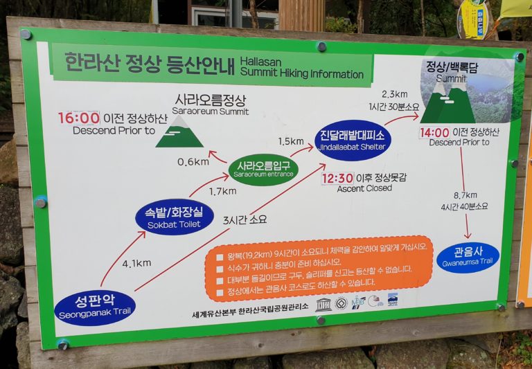
During my hike in October, 12.30pm was the latest time to start ascending from Jindallaebat to the summit. If you arrive Jindallaebat later than 12.30pm, the staff will not allow you to go through the gates to hike further.
At the summit, the latest descend time is 2pm where everyone will be asked to begin their descend before it gets too late. However, do note that these timing will change depending on that day’s weather and season, so make sure to check at the Information Centre before you start hiking.
Starting early will be good because the earlier you reach the peak, the more time you get to spend there and enjoy the scenery.
Start to first stop (4.1km)
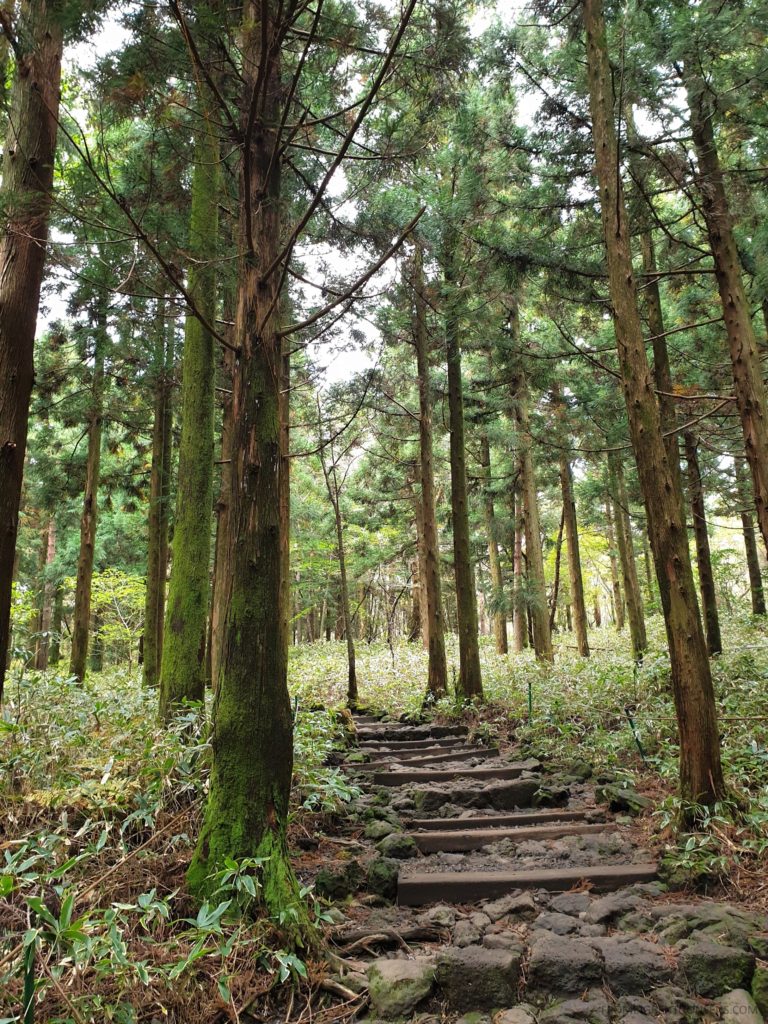
The first part of the trail is fairly flat and easy to hike. The trails are very well laid and some parts have proper wooden pathways/stairs. It felt great walking in the woods surrounded by tall pine trees and cool crisp air that makes you feel instantly energised.
There are plenty of helpful signage along the way, telling you how far you have gotten and how long more to reach the next stop. It took us about 1.5 hours to arrive at the first rest stop.
Getting to the second stop (3.2km)
This part of the trail starts to get slightly steeper and you’ll start to hike on rockier trail.
As you go higher, the clear blue sky slowly appears and the surrounding starts to get filled with beautiful autumn colours. There’s so much of orange and red maple leaves everywhere. This was definitely one of the most scenic part of the trail and don’t miss the chance to take lots of pictures!
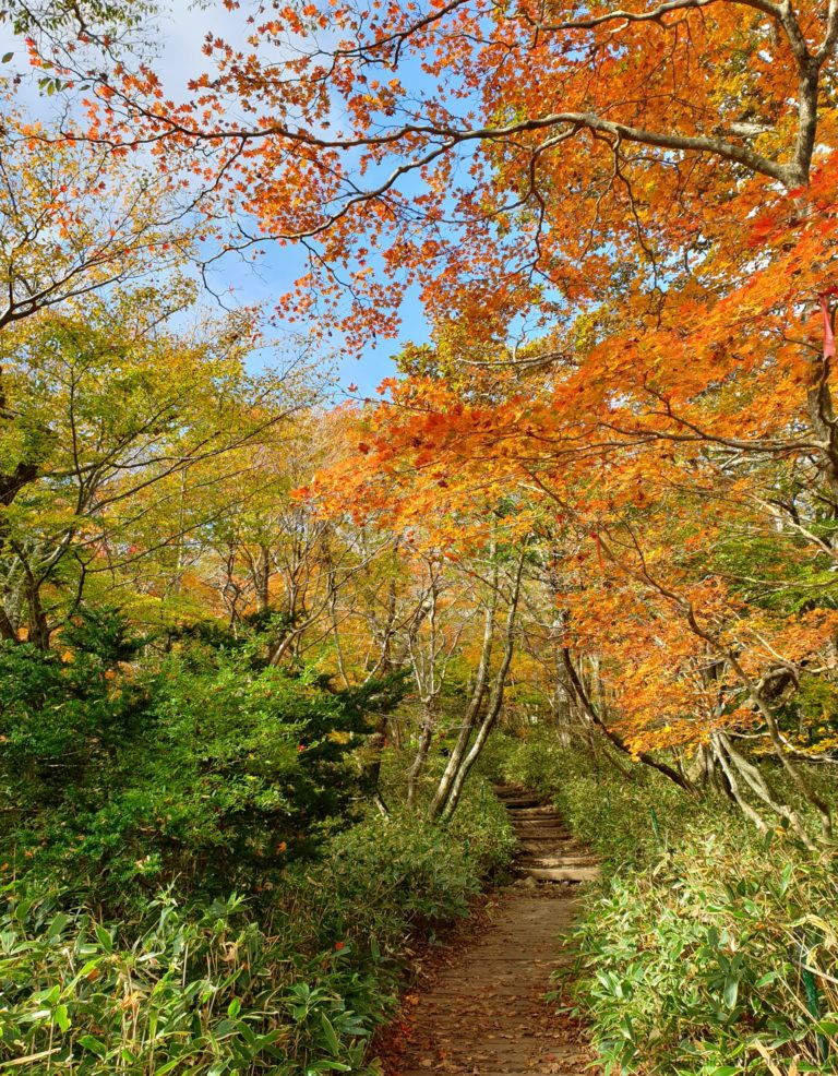
It took us about 1.5 hours from the first stop get to Jindallaebat Shelter. Most hikers will take a rest here and have some snacks before going on to the final and toughest part of the hike.
Final Leg to summit (2.3km)
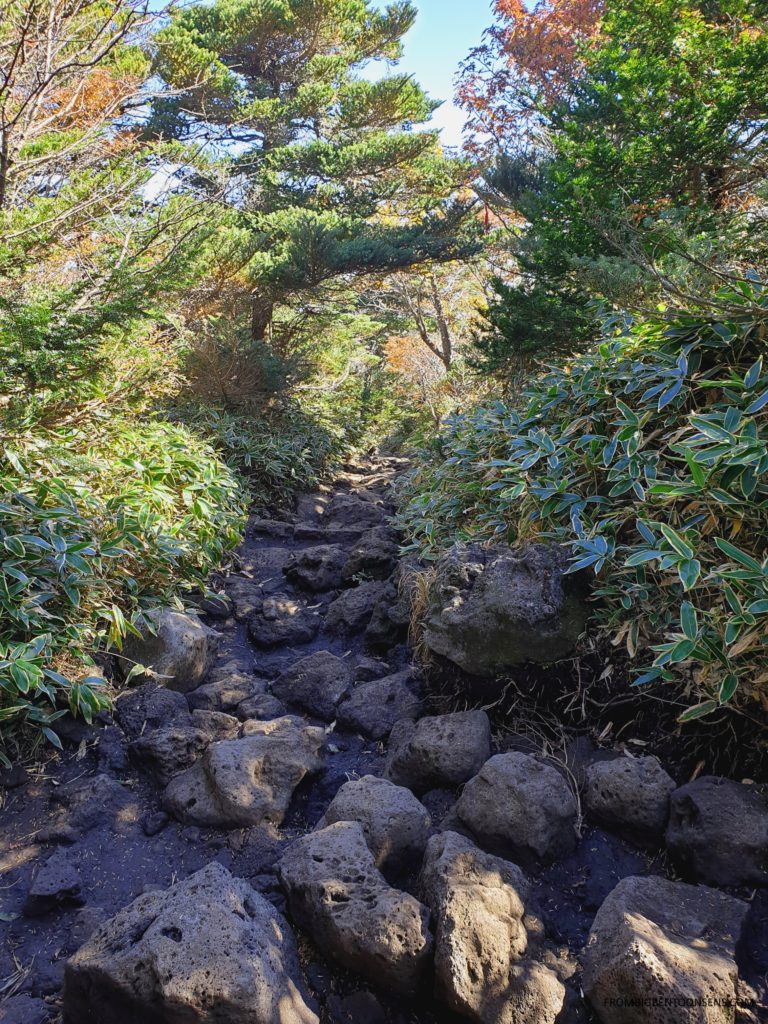
The first half of this trail is mostly large rocks and also much steeper than the previous trail.
At this point, I started to feel the soreness at the soles of my feet and the tiredness kicking in. This is always the time in any hike when I’ll start motivating myself by planning what good food we can go for after completing the hike 🙂
As you go higher, the autumn foliage starts to fade in sight and the tree canopy gets thinner, getting sunnier. Once you’re out of the forest trails, the final part of the hike is mostly walking on stairs. From far, you’ll be able to see the steps leading to the peak. The beautiful sea of clouds will also slowly come in view.
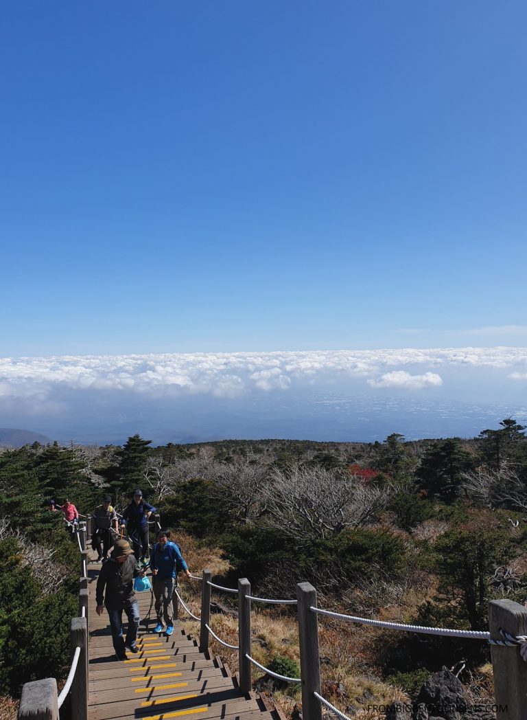
After what felt like an endless flight of stairs, we have finally made it up to the peak of Mt Hallasan! The journey for the final leg took us about 1.5 hours as well.
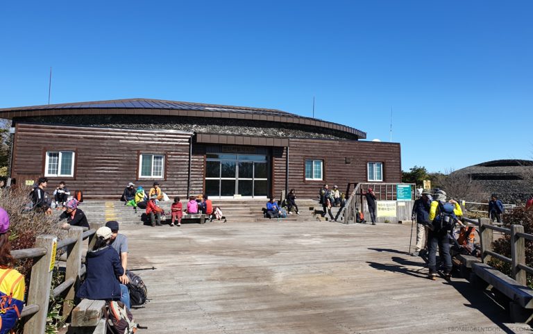
The view above the clouds was truly amazing, thanks to the perfect sunny weather and clear sky on that day. There’s a large platform for people to rest here and enjoy the view. There are even hikers who brought their own Thermos to enjoy some ramyun after the long hike!
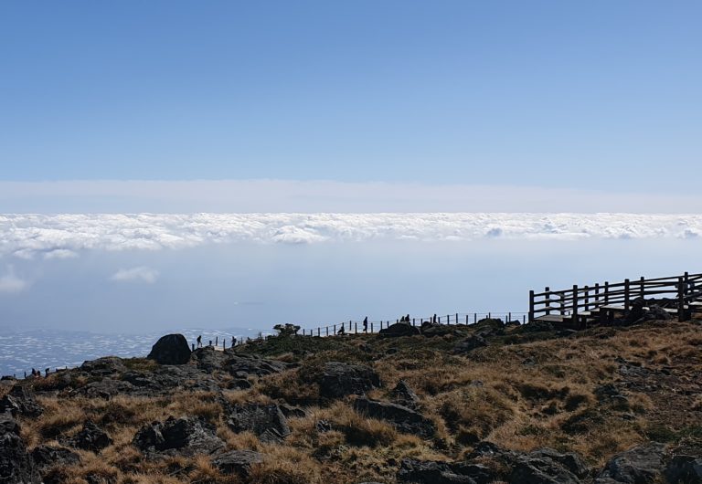
Another highlight at the summit is Baeknongdam Crater which is a naturally formed crater lake named as UNESCO World Natural Heritage in 2007. The size of lake very much depends on the weather, you may see a large lake filled with water or just a small little lake if the weather has been dry.
After having our much-needed rest and snacks, people watching and chilling for a bit, we bid goodbye to the beautiful view and made our way down. Going down was much easier and quicker, which was about 3.5 hours before we got back to your car, tired but satisfied!
That pretty much sums up my hiking experience at Mt Hallasan. Of course, don’t forget to always stay safe and prepare well before the trip.
Tips for Preparation
- Hiking essentials
I would recommend wearing hiking boots or at least trail shoes. The trail is quite rocky, especially the final section leading to the summit. If the soles of your shoes aren’t thick enough, you’ll probably be experiencing intense foot massage for hours. A walking stick would be helpful too.
- Bring your own food and water
Since you’ll be hiking for about 8 hours, remember to bring food and sufficient water to keep yourself hydrated. Even though we read some reviews that there are drinks sold at the rest stops, none were open during my trip.
- Bag for keeping trash
There is no trash bin along the entire trail and hence bringing a bag for trash will come in handy.
- Wet wipes or hand sanitiser
There will be two toilet stops along the trail and they were very well maintained and clean. The only thing is that I somehow couldn’t find any taps to wash my hands, so do bring along your wet wipes/hand sanitizer.
- Jacket/Windbreaker
Bring a jacket or windbreaker depending on what season you’ll be hiking. It definitely feels much colder when you get to the peak high up at 1900m.
Hiking to the peak of Mt Hallasan was probably the best part of my Jeju trip and I don’t mind doing this again, probably another season for a different view. Even though tiring, the breathtaking view along the hike and at the peak was totally worth all the time and effort!